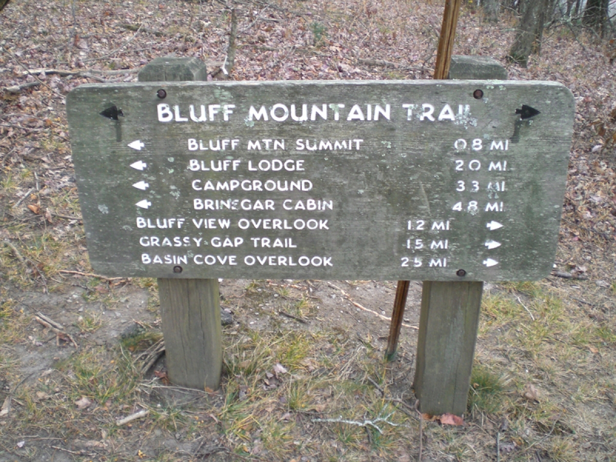
I hiked up the Bluff Mountain Trail to Alligator Back, across the hill tops past the Bluffs Lodge to Wildcat Rocks, and back to the beginning. Given the fairly cool weather and cloudy overcast sky, I was surprised by the large number of other hikers I saw. Every group looked like a multi-generational family with grandparents, parents, kids and dogs. Yes, every group I passed on the trail had dogs, mostly big ones.
I am happy to report that after half a decade of trying, I finally figured out an aspect of my DeLorme PN-60 GPS. This unit has been repeatedly reviewed by Backpacker and other outdoor magazines as the best hiking GPS on the market. It has the most detailed maps, the best download function and most powerful features to tie together functions into complex trip planning tools. That may be true, but the functions are not intuitive, not user friendly and are not explained in any way on the screen. Most functions require a combination of a dozen or so steps and button pushes, in apparently random order, which require [for me, anyway] months of trial and error to stumble across the solution. It is like a Rubik's Cube for maps. On this trip, while answering the call of nature for number 2, I was sitting and hanging over a comfortable log, when I decided to pass the time by playing with my DeLorme. I now know how to place a waypoint pin to mark a location, save it, name it, hike away from it, and then plan a route to navigate back to the original location. Won't miracles never cease!


