The organization is Bob Laney and friends, planning and leading outdoor trips. We aim to increase participants' understanding and appreciation of the outdoors, nature and wildlife. All persons are welcome.
Upcoming events are listed below. If you have questions, would like to participate or suggest a different trip, please contact us.
Stories of prior trips with photo slide shows are accessed by clicking the Newsletters button at top of this page. Also please see the Equipment articles and Links to similar web sites and other information using the above labeled buttons.
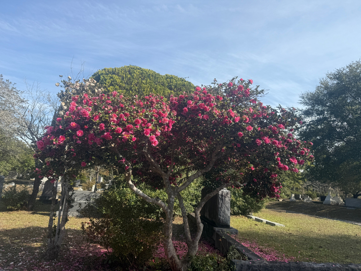
During many early morning trips to Oakdale Cemetery in our neighborhood by Bob, Janet and Gracie, we saw a nearly endless series of blossoming trees and bushes, mostly camelias which bloom all winter and into early spring.
I was not able to get photos of our many wild animal encounters. We saw a beautiful, healthy adult red fox loping across the grave sites; flocks of ibises which are normally seen in salt water estuaries and not this far inland; fur on the ground evidencing a fight between a racoon and some other fierce animal; and the mostly chewed hind leg of a whitetail deer.
The photo of Pembroke Jones' grave marker is to show the burial site of a former wealthy citizen of Wilmington, NC, for whom the common phrase "Keeping up with the Joneses" originated.
The photo of Henry Bacon's grave marker is to show the burial site of the architect who designed the Abraham Lincoln Memorial in Washington, NC.
The photo of David Brinkley's grave marker is to show the burial site of one half of the famous TV news reporter team of Chet Huntley and David Brinkley in the 1960's.
I also don't have photos of two more important citizens buried in Oakdale, but Janet and I have often walked past the site of the man for whom McRae Peak on Grandfather Mountain is named; and the man for whom Kenan Football Stadium on the UNC Chapel Hill campus is named.
And, as you can see, I love to look at and photograph big, old, moss and ivy covered live oak trees.
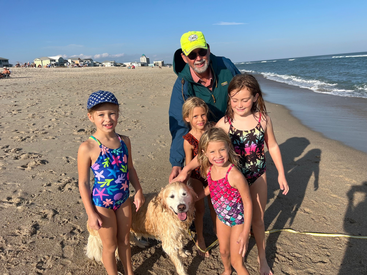
In late autumn 2025 Janet, Bob and Gracie took an afternoon trip to Wrightsville Beach north end. While there, we had the good fortune to encounter a wonderful group of little girls who loved to pet Gracie. Everybody had fun together.
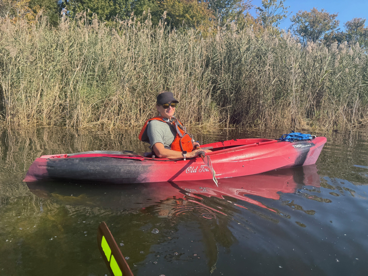
Lake Sutton Last Paddle of 2025
In late fall of 2025, Janet Smith and Bob Laney went on our last paddle of the year. Bob paddled his sea going Eddyline Sitka XT kayak which he had for a couple years. Janet had recently switched back from her newer and sleeker Wilderness Systems Tsunami 135 Pro to her older Old Town Trip 10 Angler, with which she was more familiar and comfortable.
We had seen Lake Sutton on maps a few miles west of Wilmington, NC. It was the cooling lake for a nearby electric power station. Upon turning off the main highway onto the long paved driveway, we discovered that it had an idiotic number of steep asphalt speed bumps spaced every few yards for a couple miles. At the end of the driveway was a huge NC Wildlife Resources Commission parking lot painted for motor boats and trailers. Strangely, it was empty, even at late morning on a warm, sunny day. My experiences at most other river, lake and ocean side parking lots in this part of the state are that they are always full of pickup trucks and trailers, from dawn to dusk, year round.
We later learned that the lake contained chemicals from the power station which semi-poisoned the fish. A local law limited the catch to just a couple fish per day, so nobody wanted to fish, paddle or motor boat here.
We put-in at the dock and ramp beside the parking lot. Janet and I had a leisurely paddle around the perimeter of the lake. The lake was surrounded by swampy areas, concrete walls and thick brush. There was nowhere to get out of our boats and onto the shore for our picnic lunch. We saw almost no wildlife. After a couple hours, we decided to head back to our put-in for our take-out and go home. We took a short cut and paddled straight across the middle of the lake. As luck usually has it, just as we started across the lake, a strong wind blew up directly in our faces, trying to push us backward. So, we got a good physical workout paddling to the ramp. This trip will probably be our last one here.
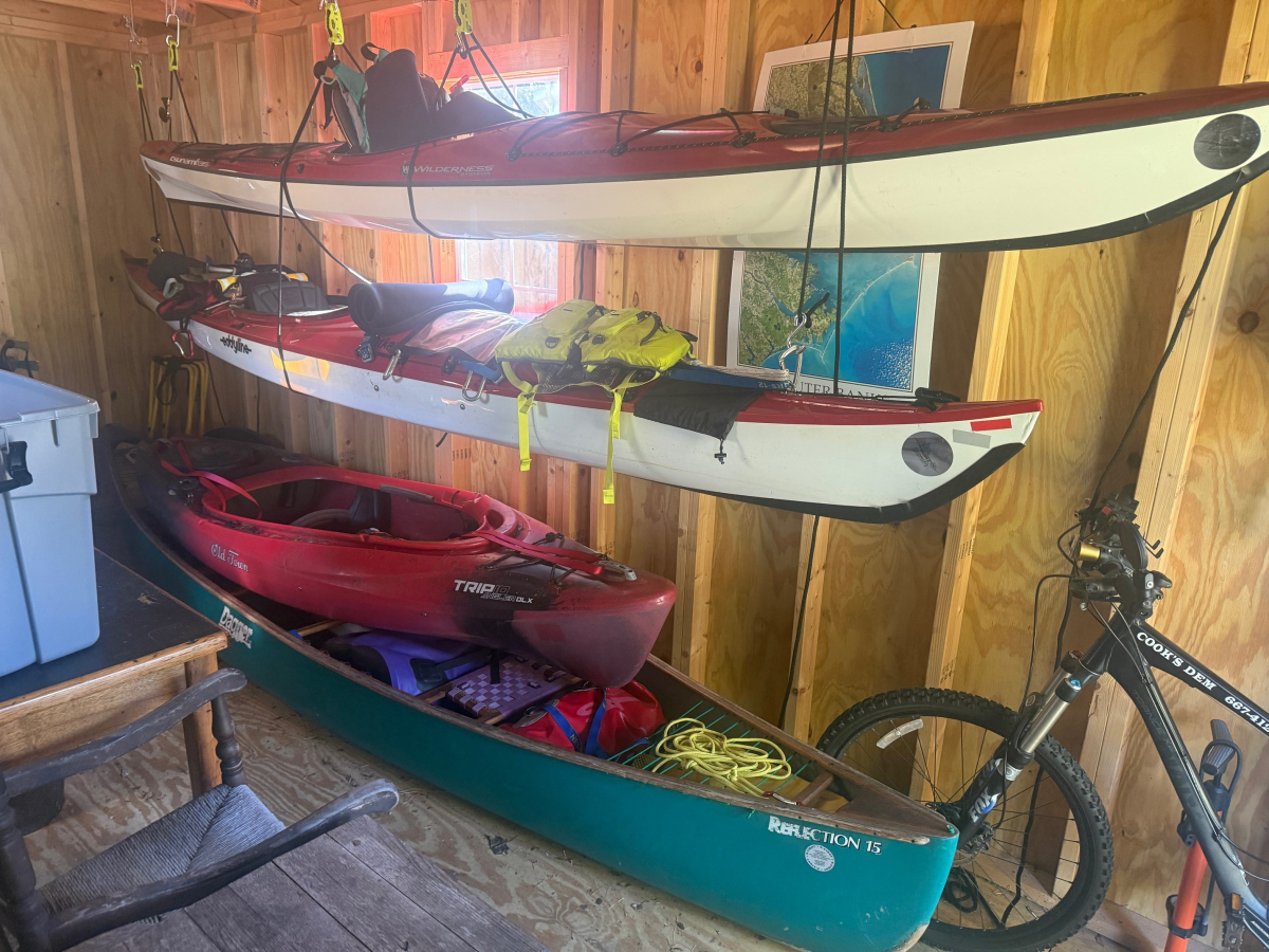
Can’t have Too Many Boats, Bicycles or Packs
An outdoor sporting couple like Janet Smith and Bob Laney cannot have too many boats, bicycles or packs.
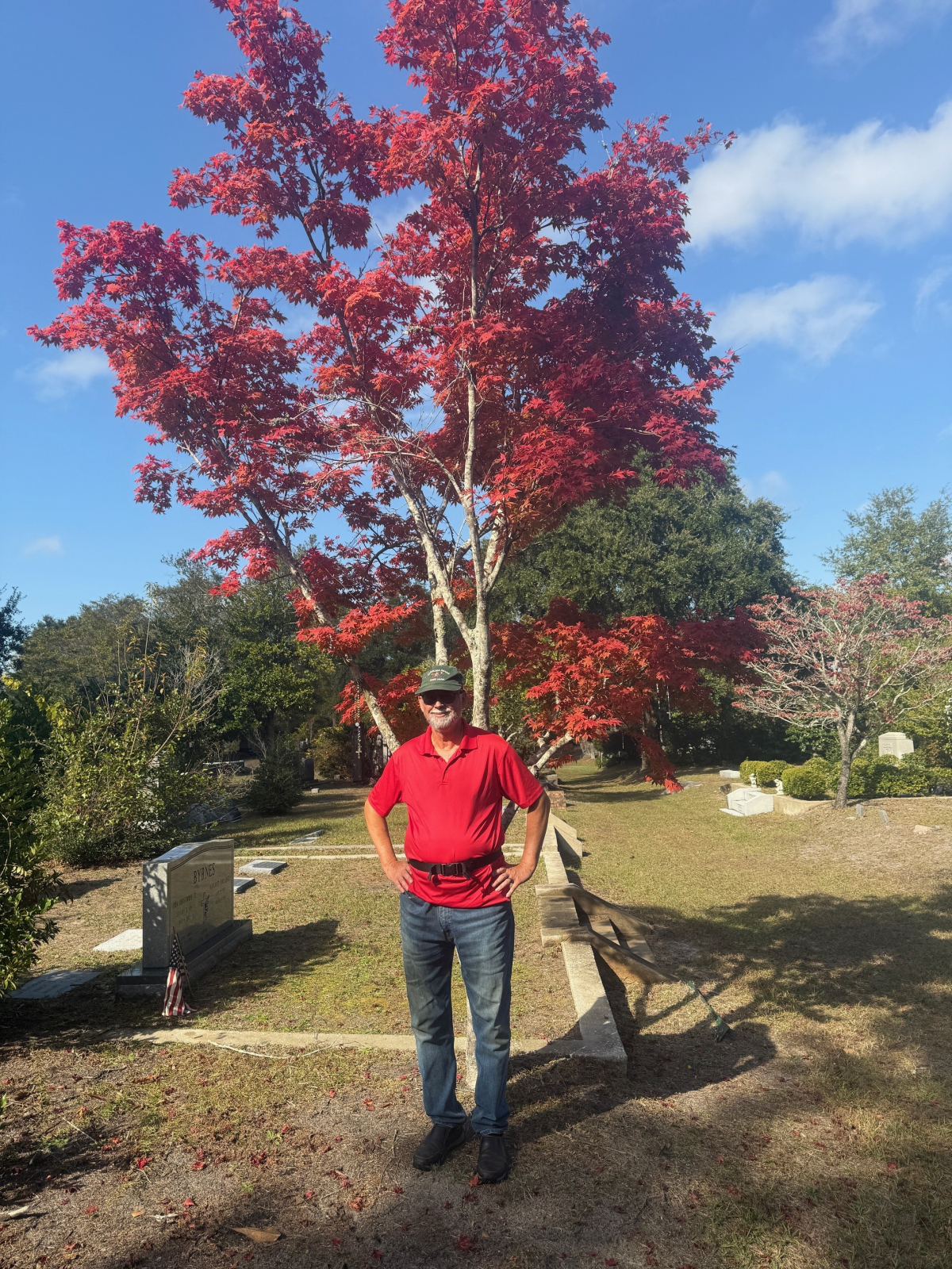
Fall Colors and Old, Old Grave Sites
While on many morning trips in the last month to Oakdale Cemetery to walk, throw sticks to Gracie and occasionally ride bicycles, here are some of the beautiful and thoughtful sights we experienced. Some fall leaf foliage, some late blooming flowers and bushes, and old grave sites. A few of the grave stones showed persons who were born in the late 1700’s.