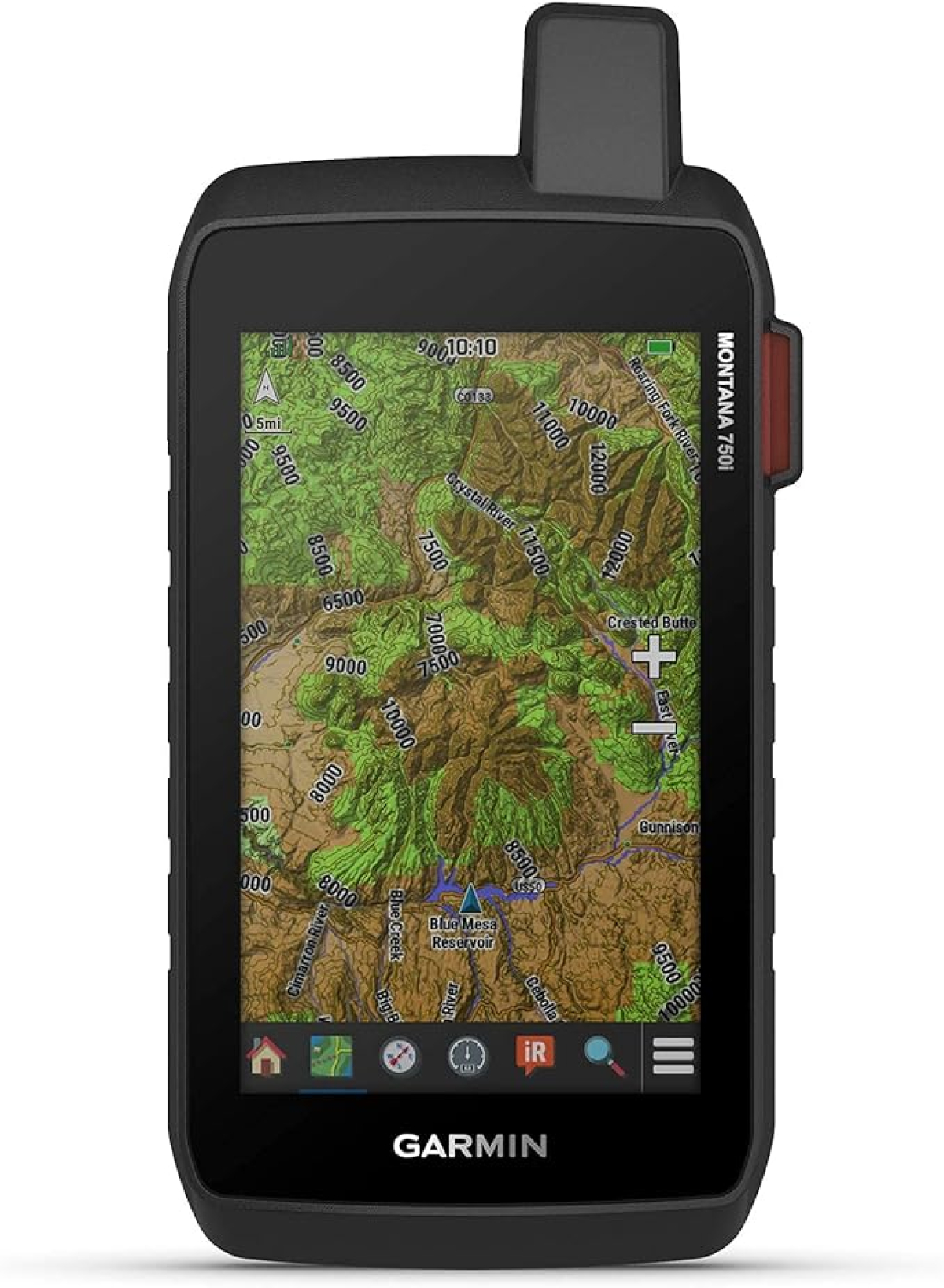
Occasionally when somebody posts an Internet question or concerns about navigating outdoors, I reply by recommending that they acquire a Garmin Montana Mapping GPS 750i. The downsides are that this device is about the largest, heaviest, most complicated, most difficult to learn, and the most expensive GPS on the market.
The upsides are that this is the most powerful GPS on the market; with the most features and functions; a large, color touch screen like a smart-phone which displays a map of the countryside where you are and a precise pointer with your exact location on the map; an automatic tracking function which you can follow back to your trip beginning; a built-in camera to avoid carrying another device; all the course, route and bread-crumb trail navigating functions that you can imagine; 911 signal generator to rescue agencies; and the ability to directly communicate in real-time texts with agencies and your own friends.
The features are too many and too complex to cover in this message. However I have learned a few tips not documented in the Garminn manuals. Here are a couple tips.
Before a trip, plug the Montana into your computer. On the computer open the Garmin BaseCamp program which comes with the device. In the left column open the Montana Memory Card (computer Drive F). Then open the TOPO US 24K Southeast map which you must download from the Garmin website. Zoom into the nearly lowest elevation. In the upper navigation bar select the mouse pointer arrow (not the cartoon hand mouse pointer). Place the pointer on the location of the trip. Then click the mouse. See a pop-up information box with the relevant USGS quadrangle map name. Click on the quad name to show a colored outline of the whole quad location. Now you know which paper USGS map to take on your trip. If you keep notes about the trip somewhere, you can add the map quad name to your notes.
After the trip, plug the Montana into your computer and the computer screen automatically opens to show the data in the Montana. From here you can move your trip photos to the computer to save, share or publish.
After the trip, turn on the Montana, and in the Home screen open Waypoints. Choose a waypoint from your trip. Click to open. Read the Latitude and Longitude to add to a published article or to share with a friend needing directions to that location.
