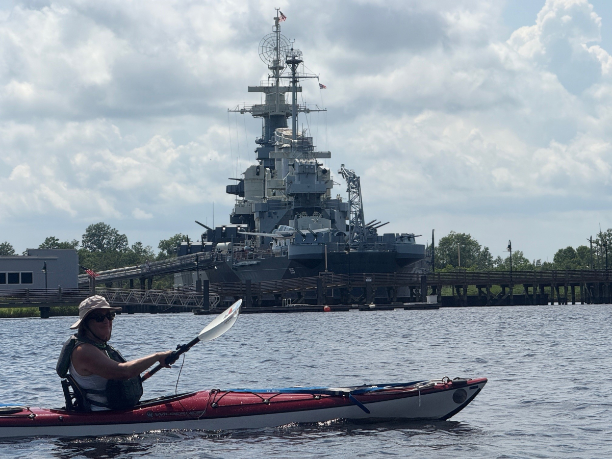
On June 21, Janet Smith and Bob Laney kayaked a small part of the Cape Fear River. We launched from the dock and ramp at Dram Tree Park, under the US Hwy 17 Business bridge over the river, at the west end of Castle Street. Our trip took us beside the downtown Wilmington, NC, waterfront and along the River Walk boardwalk.
We started paddling upstream (north), which was deceptively easy. We were going with the rising tidal current about two hours past low tide, with no discernable river (gravity) current. We passed many walkers, large yachts and luxury condo’s.
Our turn-around was about three miles upstream, at the US Hwy 74 bridge. We knew that upon reversing course and heading downstream, the tide would be against us. But, I naively hoped that the river (gravity) current would counter-act the rising tidal current.
It did not.
At the upstream bridge, the river banks narrowed, which made the current faster. I immediately recognized for the first time the strength and speed of upstream tidal current. Adding to our problems was that heading back to the take-out [at the put-in] the weather report was wrong. Instead of the 5 mph predicted wind, we encountered many prolonged situations with 10 - 15 mph winds directly against us.
The paddling was so hard that I could barely make headway. Janet was not strong enough to make any headway. She was mostly standing still relative to the river bank, and occasionally going backwards.
Luckily, just the day before, I had re-configured my kayak rear deck tow rope so that I could deploy it without having to beach and exit my boat. Where we were, there was no beach – just several miles of six feet high vertical concrete and timber walls lining the river bank.
Upon hooking to Janet’s boat, the tidal current pushed us upstream so fast that we bumped into the curved bow of a huge metal barge. I steeled my nerves and prayed that neither one of us capsized. I had a terrible concern that we could be pushed under the barge by the current, get caught on something and drown before we escaped. Within a few seconds, I got our boats oriented downstream and pulled us away from the barge.
The next hour of paddling with all my strength and all my determination, pulling two boats for three miles against a relentless tidal current and a heavy wind, took tremendous exertion. Lately, I have been going on paddling trips to build up my endurance, so sometime in the near future I can paddle with my Twin River Paddle Club friends from the Beaufort waterfront to Shackleford Banks. I don’t know how today’s Cape Fear River paddle will compare to a Shackleford trip, but I certainly got a good workout. We hope to see everybody on the water soon.


