Masonboro Island with Wilmington Paddlers
On August 30 I joined the Wilmington Paddlers club under the able leadership of Gabrielle on their trip from Trails End Park to Masonboro Island. Being as it was Saturday morning of Labor Day weekend, and the Trails End parking lot is usually packed with pickup trucks hauling motor boats and trailers, I arrived early, at 7:30 a.m. I got lucky and found that nobody had parked in the best spot right beside the launch ramp, so I took it.
We put in right at the bottom of low tide. Most of our approximately ten paddlers were on stand up paddle boards. There were two other kayaks, being a sit on top and a fishing boat, both with flat bottoms. My kayak was the only one with a sharp V hull, which meant it took the most draft (water under the boat to float above the bottom). As a result, my boat dragged several times on the sand bars and mud flats at low tide. On one mud flat, I could see the bottom was several inches under water, but I kept having a very hard time pushing past the flat. After I got to the other side, I felt my rudder handle and realized it was down. I had dragged my rudder through about 50 feet of mud. Duh!
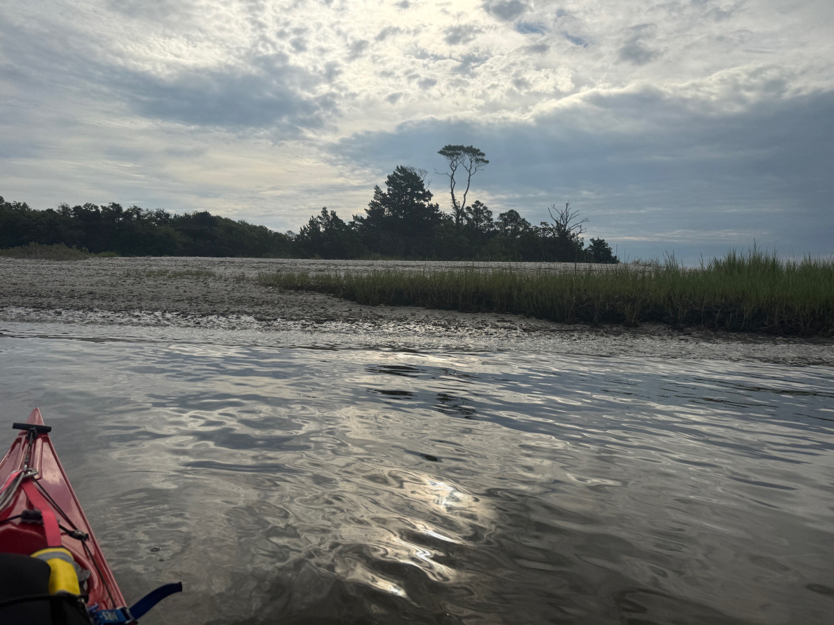
We ventured into the Intracoastal Waterway, and turned south, paralleling the western edge of Masonboro Island. We passed two small sand beaches with trees behind them, which I noted as potential camping sites. Then we turned east and entered the myriad narrow, winding water leads through about a mile of sea grass beds between us and the dry ground of the Atlantikc Ocean beach on the other side of the Island. Several paddlers made suggestions of where we should go. But eventually we ran out of water and came to a dead end.
Again, several paddlers made suggestions of where to go next, and the group agreed to return to the ICW the way we had come, then go north and play at some larger beaches. Somebody named a fellow paddler (not Gabrielle) and jokingly said that she is now the leader. The lady commented that she does not know this area, but she bravely stood tall on her SUP and scanned the horizon. Soon she ventured in a chosen direction, and we all followed her.
I had not memorized our route from the ICW into the estuary, since I intended to follow the leader, but my instincts told me we were going too far to the north, and not far enough to the west. So, I checked my GPS, and changed the screen from marking waypoints, to track back. Sure enough, we had missed our first turn by about 150 yards and were going about 90 degrees too far north. In some open water situations, being 150 yards off course is not a big deal. But in this sea grass estuary, where some of the channels are only 10 yards wide, 150 yards off course can mean being lost for a good while.
The other boaters were about 75 yards ahead of me. I blew my trusty whistle to get their attention, pointed with my paddle in the correct direction, and paddled that way. To my somewhat surprise, they all followed me, since none of them knew me, or whether I was a good navigator. After a while of leading the group, then I got into trouble. I reached a point where my GPS said to turn right, but there was no open water way that way – only grass and mud. So, I kept going straight, and each time I came to a potential turn, I kept angling to the right to attempt to get back onto our route.
Then I got lucky. I came to a long, straight channel and at the far end I could see the ICW. So down it we went.
As we progressed north up the ICW, I passed one of the small beaches which may be a good camp site. I paddled over to the edge of the water, parallel to the shore, and took some photos. Unbeknownst to me, a large boat was fast approaching from my rear. When the first wave from its wake hit me, my boat rolled about 60 degrees and I nearly capsized. Two more waves rolled under me while I frantically hit the water with my paddle in a high brace. In a few seconds, I turned my bow to meet the waves head on and get stable. This event was the first time my boat had rolled far enough over for the water to go past the cockpit rim and get onto the spray skirt; and the first time I had prevented a capsize with a high brace.
I was concerned that if we went back into the estuary later on the trip, my boat would continue dragging. So, as the group continued north, I turned off to the west and took out at the boat ramp. Later in the day, several paddlers posted trip photos, showing they got to several nice beaches on a small island on the east side of the ICW, and then they made it to the ocean beach. One of the posts showed their route. It was near what appeared to be a wide, straight channel from the ICW to the ocean beach, avoiding winding through the estuary.
I plan to return soon to Masonboro and disembark at the two small beaches across the ICW from our launch site, to walk on the land and look for places to pitch a tent. Then I will explore the larger beaches to the north which may have good camp sites. Then I will explore the large channel leading to the ocean beach for more camp sites.


