For several years I have been missing outdoor trips and sports exercise from multiple surgeries with the associated disability and pain. All along I have anticipated when I can return to solid exercise. For several months now I have been working my way up to backpacking. Many times, I walked the 1-mile trail around Smith Creek Park lake up to three times in a row for 3 miles, sometimes with a moderately heavy day pack. After 3 circuits I was not exhausted, but I was plenty sore and tired. Several times lately I have loaded a daypack or backpack for a real trip to the woods, and got dressed for cold weather, but each time I was stymied by some problem.
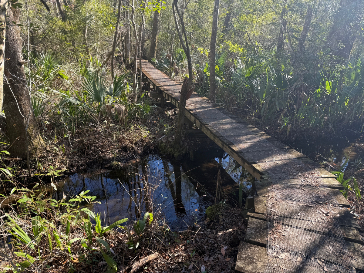
Finally, yesterday (January 17) the stars aligned, and I was able to hike part of the Neusiok Trail in Croatan National Forest. My route was from the parking lot at the road crossing at NC Hwy 306, going 3.1 miles to Copperhead Landing trail shelter. The shelter sits beside Cahoogue Creek, a tributary of Neuse River. The creek is far enough upstream that the water is not salty and can be filtered for drinking and cooking. I was concerned that I may be biting off a little more than I could chew, since during the same day, I would have to hike from the shelter back to the trail head, for a total of 6.2 miles. I had not hiked that far in more than four years.
I navigated with three electronic devices. First was my Garmin Montana 750i GPS, which performed flawlessly. The flawless functioning may not sound like much, but I have owned the Montana for about ten years, using it frequently. I never had a trip when I could figure out how to make all the function work. Something always failed to appear correctly on the screen. It is a cussedly complicated and obstinate device with nothing intuitive about its operation. The Montana also has many other satellite functions that I did not need, like sending a 911 call for rescue or sending a text to a friend. This was my first trip when everything worked to show my location and route.
The second device was my iPhone app called Avenza. This trip was my first use. It downloads maps from the Internet which are complete areas, like a state or national park or forest. Even better, it is interactive, using the iPhone’s GPS capabilities to show the user’s location as he moves along, and can be programmed to set waypoints and routes. I also glanced at the All Trails app on my phone, which was working and correctly showed my location.
Thirdly, I invented a way to find maps on the Internet, download them from the website to my computer, move them to my iPhone as a PDF attachment, and then save them on the phone as a static document. Several Apple technicians told me this process is impossible, but my son-in-law Steven Harris helped me set it up. This function is not interactive, but that map was the only one I had which showed the location of the shelter.
I had two purposes for this trip. The first one was to get to, and assess, the shelter with its water source, to prepare for a backpacking trip there in the near future. The second purpose was to test my body and see if I could hike a little over 6 miles. When I come back, I will have the disadvantage of carrying a heavier pack. But I will have the advantage of only hiking 3 miles to the shelter, with a night of rest in between, and then 3 more miles back the next day.
The first half of the trip went well. I had no problems. In my itinerary, I had allowed for going slowly, and taking 3 hours to cover 3 miles, for 1 mile an hour. Happily, I surprised myself by arriving at the shelter in 1.5 hours, for 2 miles an hour. I checked out the shelter, explored the trail to the creek and ate a spartan trail lunch. Everything was fine to come back and spend the night camping.
Hiking back to the Jeep was a different story. My pinched sciatica nerve causes two problems. The intermittent pain has never gone away despite my surgery last year. My surgeon says the pain will gradually decrease, but there is no guarantee it will totally disappear. As I walked 4, 5 and 6 miles the pain gradually grew. The second problem is the major nerve from my spine to my right leg is damaged. My surgeon says it will eventually recover, but the nerve is taking plenty of time to do so. The damaged nerve is not quite able to control my leg muscles, so occasionally I lose my balance and stumble slightly forward. Each time I was able to catch my self and not fall to the ground, but the incessant stumbles several hundred times was wearing and tiring.
Another factor was that I was using muscles in my hips and thighs which had not felt this form of exercise for 4 years. As I progressed, they began to hurt. By the last mile back to the trail head I was considerably tired, sore and in some pain.
I had my single wood hiking staff, but it was not sufficient. With only one pole I was not fully secure and balanced. And with no wrist strap, I got a blister on my hand from gripping it. Next hike or backpacking trip I will use my two trekking poles with straps.
Astoundingly, when I arrived back at the trail head, I was amazed to see that I covered the final 3.1 miles in 1.5 hours, at 2 miles an hour. The same speed as the first 3 miles. I frankly don’t know how I did it. Next trip, I will go slower and try to spread out the wear and tear on my body.
A good time was mostly had by me.


