On the cool and mostly sunny day of November 25, Janet and I (Bob Laney) went on our longest paddle trip to date. We were outside for about 5 hours. We put-in our two kayaks at the Wrightsville SUP parking lot. It is located off West Salisbury Street (US Hwy 74) on Harbor Island, just west of the bridge over Bank’s Channel near the northern end of Wrightsville Beach. This place has a beautiful and handy little sand beach with a long, shallow slope into deeper water. Note to readers who may want to use this put in. It is not a public parking lot or beach, and I had special permission from the business owner’s manager. During the busy season of April through October the business charges a fee for parking.
Our route was into Lee’s Cut, which is the northern end of Bank’s Channel. It is salt water and has several miles of sea grass estuaries with winding, undefined channels. I attempted to use my Garmin Montana 750i GPS for navigation, but it only half worked. It showed a track where we paddled, but the map on the screen did not show enough detail of the sea grass beds to tell which fork to take and where to make turns.
After I got home while typing this article to post, I did some more map research and found that Google Earth on my cell phone screen shows good detail. Next time I will use both the GPS and phone.
After entering Lee’s Cut, we turned left and went about 75 yards and turned left again under a short, low bridge. From there we wound through the estuary most of the way to Causeway Drive (US Hwy 76).
Then, I tried to activate the return function on the GPS to follow our track back to the put in. But the sequence of buttons to push and icons to tap were so convoluted and confusing that I could not make it work. That made me mad. It took several minutes of Janet’s pleasant humor and encouragement for me to get back into a good mood and enjoy the rest of the trip.
We could have, and should have, gone a short distance further to the end of the estuary at Causeway Drive. But I was upset with my semi-dysfunctional GPS. I was nervous that we could not find our way out of the sea grass maze. So, I pushed Janet to turn around sooner than she wanted. Next time, we will go all the way to Lee’s Nature Park beside Causeway Drive. On perhaps other future trips, we will go further west to the Intercoastal Waterway and further north to Big Lollipop Bay.
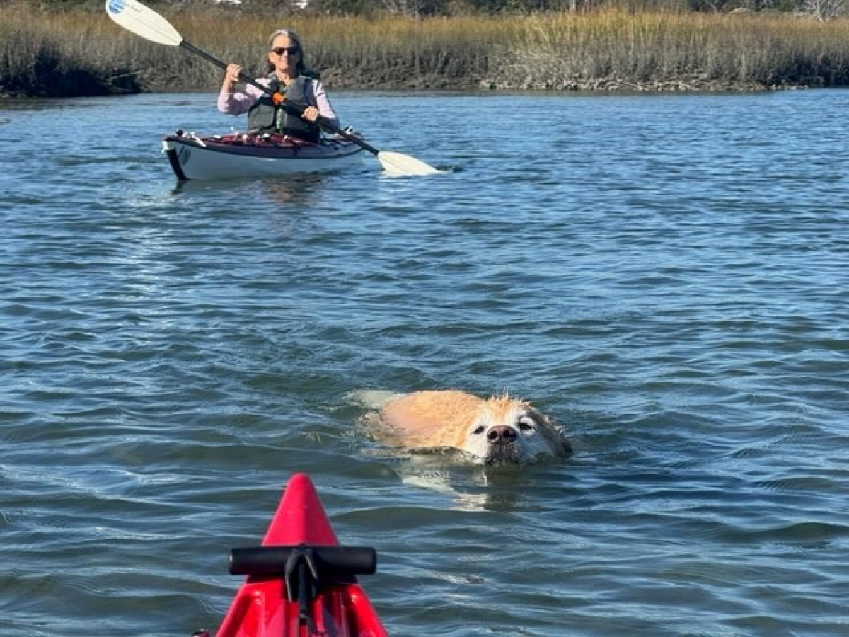
Janet’s golden retriever Gracie swam the whole way with us. After a while, she got tired. Then while heading back, the tide was against us. Out boats were sleek enough to sufficiently slice through the water, but in several places Gracie could not make headway. We moved the boats over to paddle beside the shore and encourage Gracie to walk instead of swim. But the banks were paved with a solid carpet of sharp oyster shells. Gracie severely cut her paw and bled significantly. The next day Janet took Gracie to the veterinarian who used four staples to close the wound.
After returning to our take-out at the quaint little beach, I unpacked all my gear from my kayak and loaded it with my cold-water clothes (wet suit and booties) into the Jeep. About 10 minutes later Janet let me know she was not finished paddling and wanted to go out again. My sciatica pain had grown to the point that I decided to stay on the beach with Gracie.
Janet deputized me to go into Wrightsville Beach town to get some lunch. But the restaurant she chose was closed, so we did without lunch.
Janet took off kayaking solo and crossed a large stretch of open water to another small beach on the other side of Lee’s Cut on the south side of an unnamed island. There she conversed with some other paddlers and learned of another route. She followed their directions and went further north on a channel through sea grass. When she reached the houses and docks off Parmele Boulevard, she followed the channel circling to the right (east) around the unnamed island. She eventually came back to US-Hwy 74 and went under the bridge into Banks Channel. I began to get worked for her where abouts and called her on our cell phones. She responded and, in a few minutes, we were back together at the take-out.
A good time was had by all.


