After most of the week’s fairly cool mornings and blazing hot afternoons, Janet Smith and I [Bob Laney] needed a paddling fix. In the late morning of Saturday, August 31, we tried to access Badley Creek. We saw advertised in a year-old Wilmington tourist magazine a new Bradley Park with a kayak dock and a handicapped roller launch. We followed my Jeep’s GPS through remote neighborhoods on small, winding dirt paths leading to the Creek. Then at the end of a narrow, rough, steep track, we came up against a power pole making the track a dead end. The pole overlooked a footpath down to the creek. I slowly and carefully backed out between two steep drop-offs into the water for about a block. We talked to several neighborhood persons who had never heard of Bradley Park. Finally, a nice young lady walking her dog on one of the dirt paths informed us that the Park and kayak launch had never been built.
Janet and I debated several other local paddling locations and settled on Greenfield Lake Park. We had paddled there once before and had trouble with dense beds of water weeds hindering our paddle strokes. Sometimes we had to jerk our paddles so hard to free them from the mass of plants that we nearly capsized. Another problem is that the lake is a swamp full of cypress trees, Spanish moss, and no marked trails. A paddler cannot tell where he is on the lake and cannot see across the lake; making it difficult to find the take-out. Janet graciously acquiesced to my plan to circumnavigate the lake sticking to the shore.
Along the way we spotted what looked like a log floating in the distance. Upon closer examination, we determined it to be an alligator. As we paddled further, we came upon a group of about five alligators chasing a school of fairly large fish, which caused the intended prey to repeatedly jump out of the water and create a 30-yard-wide boil. Janet got the closest and took a good alligator photograph, shown below. It looks like a long, thin, bumpy log floating just barely above the swamp surface.
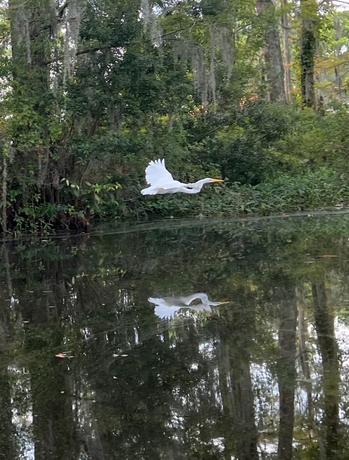
Best of all, Janet spotted a snow-white egret on the bank hunting for fish. She slowly, quietly, and expertly glided up to the bird without spooking it. After being subjected to a couple of pictures, the bird flew off across her bow. Janet got an excellent photograph of the egret with wings extended in flight.
After getting to the far end of the lake, we followed our paddle route back to the put-in where we started. I used my Garmin Montana 750i GPS and iPhone app All Trails to trace our route. They both showed a line on their screens marking our watery path. I occasionally checked our location. On our return route, both devices helpfully showed me the narrow water trails between swamp islands and boggy isthmuses to the take-out. Janet sometimes makes fun of me for playing with my electronic devices too much, but I get comfort in knowing where I am and how to get where I am going.
When we returned to the take-out and loaded our boats on the Jeep roof rack, we brought home dirty hulls covered in swamp muck.
A good time was had by all.


