Navigation Challenge
Since joining the Boy Scouts at age 11 years, I have been trained to be prepared. For most of the intervening 61 years, when I took an outdoor trip that involved moving across water or terrain, such as canoeing or backpacking, being prepared included knowing where I had been, where I was located and where I was going. At the beginning, I used a map and compass. One of the drawbacks of a map is that the most commonly available types of maps covering the whole country are the US Geological Surveys 7.5-minute series. These maps cover so much area on such a small scale as not to be helpful on a short trip. Further, the map does not tell you where you are without many slow, tedious observations and calculations. Lately, I have learned that a GPS will faster tell you where you are and where to go.
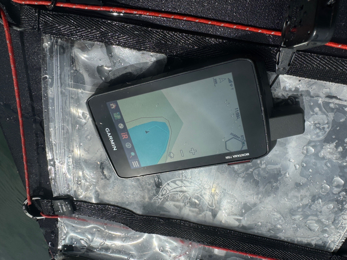
Since I moved to the NC coast a couple years ago and took up kayaking, I have usually used my GPS on outdoor trips. But it’s use is hindered by several factors. First, water drips off the paddle handle onto the. GPS screen. The screen reacts as if I have touched it with my finger. Then the device goes to another function that I don’t want.
Second, I have tried using plastic waterproof cases, but they lead to the problem of looking through another transparent layer which reflects the sun and makes the screen un-discernable.
Third, when I try to input data, the icons and keyboard, are so tiny and delicate that I cannot get the data input correctly.
Finally, the water on which I am kayaking is rarely still. There are almost always waves, wind, currents and / or tide. Whenever I stop to fiddle with my GPS, then I am often blown off course. Or, since I have to stop paddling, I usually fall behind the group I am following which increases the chance of getting lost.
The attached photographs are from my last paddling trip on September 11 to Smith Creek Park lake to work with my GPS. I encountered a 10 knot wind. Whenever I stopped to work with the device then I was blown into the weeds surrounding the lake.
When paddling with the TRPC group, I have not noticed anybody, even the leader, using a map, compass, GPS or other navigational aid. How do the paddlers know where you are located and where you are going? I assume most of the trips are to where the leader and most of the members have already been and know the route. But since I am new to the area and do not know most of the routes., then I need some assistance to navigate. Even if I'm with a group and following a leader, still have the responsibility of protecting myself. If a problem develops with the group or the leader, or if I get separated from them, then I will be responsible for getting to the take out.
I would enjoy receiving from TRPC members or friends suggestions for how I can best. function in these circumstances. How do you navigate? Suppose it is a new route?
336-984-6860.
Have a great day. Your friend, Bob Laney.


