Sims Pond / Green Knob Trail
This hiking trip was part of the larger 2025 annual week long Laney family reunion and July 4th holiday at the family’s two Blue Ridge Mountain cabins on Shull’s Mill Road in Watauga County, NC. Each year some of us take one or two fairly rugged hikes in the nearby mountains.
Some years ago, when we were younger and tougher, we would do extraordinarily long and committing hikes, like all the way from the bottom of Grandfather Mountain at NC Hwy 105 or U S Hwy 221, up and over all three peaks at 6,000 feet altitude, then to the Swinging Bridge, and back to the beginning. Or, from the ridge atop Linville Gorge at Kistler Memorial Highway, down and around in Linville Gorge and back up to the beginning.
Our current ages range from the mid-60s to the mid-70s years. As we have gotten older, we have shortened the trips, but we still go somewhere with plenty of nature and the outdoors to experience.
This year, brother Frank led siblings Jack and Bob, brother-in-law Larry and grandson Isaac on the Sims Pond / Green Knob trail. It makes a big loop just north of Price Park, goes around Sims Pond, climbs Green Knob and crosses the Blue Ridge Parkway twice. The upper (higher altitude) side of the trail happens to pass near one of the Laney cabins on the far side of a cow pasture. Frank knew of a cow path through the pasture connecting the cabin to the trail.
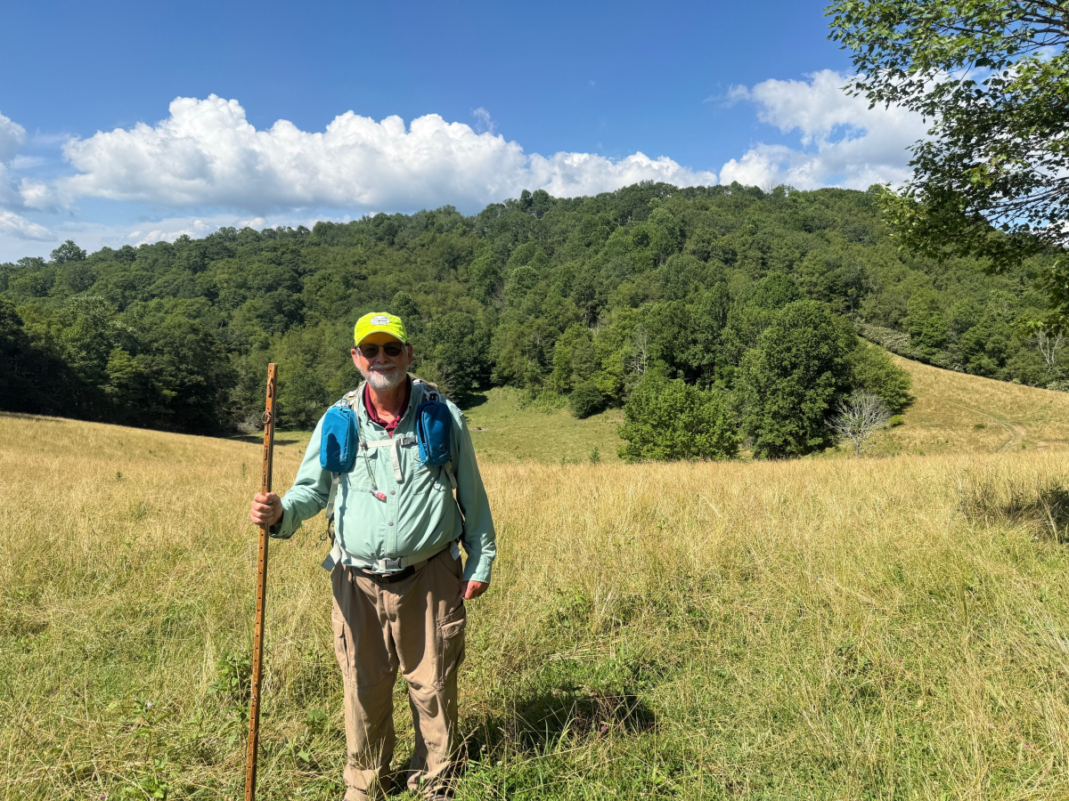
The trail starts a hundred yards south of Sims Pond, on the west side of the Parkway, and dives directly into deep woods. Following it clockwise, it soon steeply climbs a dirt, rock and root path up Green Knob. On the other side of this mountain, it crosses some grassy meadows where the cow path goes to one of the Laney cabins. Then it follows a creek fairly steeply downhill, under the Parkway, and feeds into Sims Pond.
Before the trip, I had a couple of dilemmas. Take hiking my staff or leave it at the cabin? Wear a long-sleeve shirt and pants or shorts? I opted to take the staff, which was a very good decision. There were numerous places on the trail that were so rough, or steep or slick that I would have been in trouble without it. Then, I chose to wear long pants and shirt, and found it was a mistake. I got way too hot. Oh well, you win some, and you lose some.
I had hiked this trail once several years before and remembered it as fairly simple and benign. My memory was way wrong. Parts of the trail were extremely rough and steep, and kept going that way for a long time.
Some of the ruggedness was because of the mountainous terrain where the trailer is located. Other sections were made more difficult by the hurricane Helene damage last year. It had scoured out big sections of dirt, exposed large rocks and roots, damaged steps, and toppled trees across the trail.
My Garmin Montana GPS reported that we covered four miles in three hours and gained 800 feet altitude. This information does not sound like much of a big hike. But given our ages, it was all that we wanted to do. We were glad to get to the top of the cow pasture and return to the cabin for soft chairs, drinks and food.


