McRae Peak Realization
Grandfather Mountain in the Blue Ridge Mountains of northwest NC is my home base. My family has owned a cabin near there since the year I was born. This mountain is my main location for recreation. I identify with Grandfather so closely that my Last Will and Testament directs my executor to sprinkle my ashes on the Boone Scout Trail. In case that action is illegal, I warned him to keep an eye out for the law.
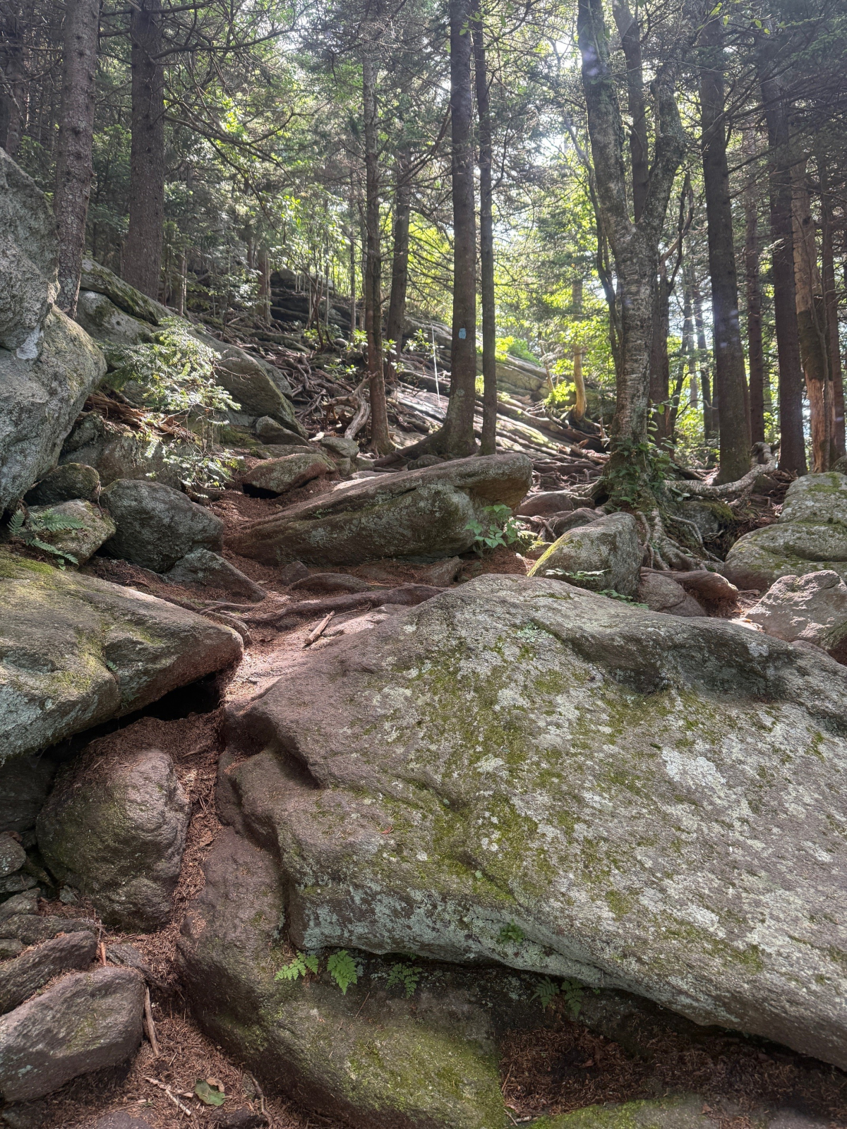
I have hiked and backpacked all over the NC mountains and know most of the trails. The Grandfather Trail is the most rugged and has the most exposure. My pictures of the trail in this social media post do not do justice to the steepness. The small camera lens and the perspective makes the trails in the photos look fairly benign. There are numerous places which I did not get to this day [no photos] where a slip and fall can be fatal.
I have hiked and backpacked on every trail all over Grandfather Mountain beginning at the age of 12 years, and for the next 60 years, close to 100 times. During my family’s annual July 4th reunion and holiday this year, I hiked the Grandfather Trail, traversing from the Grandfather Mountain private attraction to the State Park, starting from the Black Bear Trail parking lot (below the Swinging Bridge) towards McRae Peak, at over 6,000 feet altitude.
I have traversed this particular section of trail probably 30 times. But I had not been here in about 15 years. And in the interim, I have had surgeries for both hips and back, and many major muscular and skeletal injuries, followed by long stretches of recuperation. The result is years of insufficient exercise. My physical strength and stamina have deteriorated.
After living in the western piedmont NC and in the Blue Ridge Mountains most of my life, several years ago I moved to the NC coast. This trip going back to the mountains was a kind of reunion.
On my drive to the trail that morning, I had the first inkling that things were not the same as they used to be. For my entire life, I have carried a map in my head of everything in the mountains – roads, intersections, towns, stores, creeks, valleys and mountains. I never had to think about what is the route to anywhere I want to go. About half way between the cabin and trail head, I was driving, and I had a moment where I had to pause and think, where am I on the road, and which is my next turn?
The trail climbs moderately, and then steeply. It consists of dirt, rocks, mud and roots, with occasionally cables and ladders on the cliff sections. After getting about 2/3 of the way to McRae Peak, I had the realization that the steepness and roughness was more than I had remembered. As I progressed up the trail it got steeper and rougher. Many places had no trail, just areas of boulders to be climbed over, around or under. The height of the climbing sections, the verticality of the slope and the ruggedness of the places to step or grab exceeded my memory of those places.
Eventually, I felt that the trail difficulty was more than I could physically handle. It took somewhat more strength, endurance and balance than I thought I had. I felt that I would not be able to make it to the top. At the cliff face where I stopped hiking, I recognized the location with its cable, and I knew exactly where I was, but it looked strangely tougher, steeper and taller than I remembered. I felt overwhelmed with the work I would have to do to complete the climb. So, I sat down to contemplate things; and I started composing this written trip report in my head.
One sad factor is that work I did today which tired me out was about 2/3 of the trail from the Black Bear Trail parking lot to McRae Peak. That work was only about 10% of the work I had done many times when I was younger, by starting at the bottom of the mountain on US Hwy 221 or NC Hwy 105, climbing the entire mountain on the Boone Scout Trail or the Profile Trail, crossing the Calloway Peak, Attic Window Peak and McRae Peak, at about 6,000 feet altitude, then going down to the Swinging Bridge, then turning around and going back the entire way I came, in one day. One such prior trip was solo, in early December, with ice coating the trail and 90 mph wind blowing at the top.
Driving back to the cabin, I looked out on the beautiful mountain scenery to the southeast. I had a sad feeling in my gut that it is still beautiful, and I can come to visit it whenever I want. But I felt an emotional distance. I was fading mentally and physically. I can’t do all the things I used to do. I am no longer 100% a part of the mountains, and they are no longer 100% a part of me. I felt some actual grief.
I was reminded of my prior backpacking trip about ten years ago, aged in my early 60s years, with Jim Smoak Hank, Perkins and Kelly Pipes on the Appalachian Trail from Roan Mountain, TN, through Carver’s Gap, and over the multiple grassy balds of Yellow Mountain and Hump Mountain, to US Hwy 19 E. I have been there multiple times and loved the place. While hiking up the extremely long, steep trail on the north side of Hump Mountain, I almost gave out and was going extremely slowly. The other guys waited for me at the top for a long time. I could tell even then that my strength and endurance were somewhat reduced from prior years. I had the sinking feeling that this may be the last time I ever see this mountain top. Unfortunately, I have not been back.
After getting back home to Wilmington and chatting over the situation with Janet, I decided that things are not quite so bad. After some physical training and mental planning, I will go back to Grandfather Mountain later this summer. Using my better realization of what I will be facing, and my better mental preparation, I will take the same trail again and I will reach McRae Peak. Stay tuned for a later installment of this post.
N 36 05 43.50
W -81 49 45.93


